22/12/2013

Walking the Cumbrecita

A couple of days ago, we were in the West of La Palma with some time to spare - quite a rare thing as normally our expeditions south are a whirlwind affair with a whole list of jobs to do, friends to see and shops to visit. But this time, we decided to award ourselves a little treat by staying the night at an apartment in Tazacorte.
Located right by the beach, a swim was the obvious thing to do. But I had a whole myriad of other fun things I wanted to do as well - the salt pans at Fuencaliente, the banana museum at Tazacorte and walking the Cumbrecita. To name but a few. It was certainly tricky to decide but with such a beautiful day, we decided that it would be a shame to be in a museum or in the car longer than necessary and so the Cumbrecita walk won the vote. 
The Cumbrecita is not a long walk by any means at around one and a half hours, but it's a walk that packs a punch with amazing views virtually all the way. And the other great thing is that for those who are not dedicated walkers, it's not a long walk to get there and nor is it a steep walk although admittedly there are a couple of fairly narrow sections which some might be too fond of. But what you can also look forward to is a warm welcome from the resident ravens. 
The start of the Cumbrecita walk is just over 6km from the main road and it takes around 15 minutes to drive up there. But before you set off, you'll need to pop into the nearby Visitor Centre to get your pass. It's free but you will need to show your driving licence or passport as proof of identity. 
Once at the top, you can walk to one of the Miradores (look out points), either the Lomo de las Chozas which takes about 20 minutes from the car park or the Mirador de los Roques just 15 minutes from the car park. 
Or you can do the 1.5 hour circular walk which takes in both look out points. 
From here, I'll let the photos do the talking. Hope you get to enjoy walking the Cumbrecita while you're on La Palma!
You might be interested to know that detailed route notes for our walks on La Palma are now for sale, including walking the GR130, the Volcano Route, the Caldera, Los Tilos and more. Please contact us for details ann@holiday-lapalma.com


05/11/2013

New and improved walking route - La Palma 9.1

I think we can safely say that we've not been big on long walks this summer. But as usual, there has been plenty else going on including giving a temporary home to two kittens and two small dogs for two months which was sandwiched in between some restoration work and a  'flying visit' to the UK. Never dull anyway!
However, in October with family here for a week's holiday, we thoroughly enjoyed a walk from Roque de Faro at 1000m above sea level down to Franceses at 500m. It's a two hour walk and so the downward gradient is not too steep - great to chat and walk whilst still enjoying the scenery. At Roque Faro, there is the bar/restaurant El Reyes, so if you like you can pop in there for refreshments or a meal - it's a rustic restaurant serving goat and rabbit plus La Palma wines and local goat cheese, so worth a visit.
The easiest way to tackle it is to take the number 100 bus from Franceses to Roque Faro - they run every two hours on the even hour weekdays and every four hours at weekends and fiestas. You can check out the bus timetable here. You might also be interested to know that there are now whizzo timetables in the bus shelters so we've gone from a scrappy bit of paper (if at all) to a highly durable, highly master-minded board with the information displayed in three different formats. It's a quantum leap in the world of La Palma bus information. You've just gotta love it.
The start of the walk however is not easy to find so it was a good job that we already know where it is. So to begin the walk, head uphill from Restaurant Reyes and the path runs alongside the first building on the left before the church. By the way, looking above and behind the church you can see the observatories by the Roque de Muchachos - an awesome sight. And if you were to continue walking uphill to the left of the church, a four hour walk would get you to Mirador Andenes on the GR131 - but that wasn't for us on this particular occasion.
Having followed the path along the side of the building (not the most salubrious part of the walk), you quickly reach woodland. Descending down half a dozen steps of hewn logs we are already surrounded by trees, and with dry leaves underfoot and the smell of rich earth all around, the magic begins. And so do the signs.
 Almost immediately, there's an option for a detour to a spring, a Fuente as they are called in Spanish. We take a quick vote on it and the unanimous decision is that we are feeling generous enough to give it a try. OK, so it was only a 50m detour as it turned out but very well worth it, if not for the actual spring but to see the huge ferns growing by it.
So far the route has only taken us a little further on from Roque Faro but because we are in meandering woodland, you don't get a sense of this at all and feel as if you are covering some distance. A couple of years ago, the route was actually changed to this new and improved way. Before, the LP9.1 followed the road for around half a kilometre which was slightly dull but now that section has been taken out although none of the maps yet show it. The new route takes you into a dell, passes a farm and then into a clearing in the bed of the barranco where there are some sort of rock works going on. Finding the route on the other side of the clearing is not immediately obvious but as usual, if you set off on a path, there is a usually a sign of some type within a few metres. Now it's up hill back up the other side of the ravine again and in the sun, so when we arrive at El Cruce, we're all feeling a bit hot!
El Cruce is where there is a giant pine tree next to the main road, it's huge, I mean really huge. And it's also where the LP109 old road, the first road to cross the north, emerges from Barlovento. By the way, if you ever get the chance, that's an extremely scenic 15km drive complete with single track tunnels at the start - pure magic, except when the cloud is low and then it looks and feels like anywhere else does in the fog.
We only walk on the old road for five minutes before we are signposted off to the left and downhill into woodland again. After walking along a flat woodland path, we come to a gate. It's a La Palma gate. That means it 'had a previous life,' usually as a bed frame or some other random object. Oh yes, still lovin' it! Actually, we know this gate of old, or some derivation of it at least, so we know it's not a gate to keep people out but rather to keep the pig in. On a previous walk, the pig follow us for a ridiculous length of time, until we had to use persuasive methods to deter him from coming home with us. But all that said, it can be an awkward gate to open as the farmer has improved pig-security since the photo below was taken. Luckily, PJ is well versed in opening awkward anti-pig gates and very quickly the obstacle, wasn't.
We then come to our next landmark which is a house completely in the middle of nowhere and with a couple of crosses outside. There is a track which goes straight on and in fact this is where the route used to go. But now we head off at 90 degrees to the left. This is actually a big improvement because the old route was a boring concrete track that seemed to go on forever. But with the new route, we are quickly back in woodland and after walking on further, we come to the main road which we cross and go straight down a set of stone steps back into woodland.
Now it's all downhill, as the saying goes. With farmland at each side, we walk down a narrow track that has been gouged out by heavy winter rains in the past. This is the shortcut I remind myself, the way that in the old days people from Franceses would walk up to the catch the three-times daily bus from the old road. How lucky we are now to have a two-hourly bus come right through the village.
Almost disappointingly, we come to the end of the walk. The lumpy-bumpy path gives way to a smooth grassy path which in turn becomes a short concrete track which joins the Franceses village road. We've arrived. We cross the village road and head down 'our' donkey path to home. And there is home right below us.

12/05/2013

Transvulcania Ultramarathon La Palma

Monday, 11th May, 2013, Isla de La Palma. 
1684 Athletes
83.3km
The race is on.
Yes, with more participants than ever - and many turned away once the list was full, this was the fifth Transvulcania Ultramarathon. 
With one of the most grueling courses in the world following the route of the GR131 El Baston, this is no ordinary run. Normally an exacting trek taking three to four days with accumulated descents and ascents totaling 8525 metres, the winners complete the run less than 7 hours.
Starting at Fuencaliente Lighthouse at sea level, the course moves swiftly upward to Los Canarios and the volcano route, often running on sand, pine needles and volcanic scree. The views are magnificent, should they pause to bother with that. Passing through the pine forests of El Pilar and onto the isolated and magnificent ridge of the Caldera, the route ascends even further up to 2426 metres and the Roque de Muchachos, the Rock of the Young Men (and/or Women).
This is the uppermost part of the run and possibly a cause for celebration. except that from here on in, it's steeply downhill all the way to sea level, running on loose stones which cover narrow, twisting paths. Finally back down at sea level once more and the small port-side village of Tazacorte, the route of El Baston ends. But not the run. 
With a final and, dare I say, painful twist the Transvulcania demands that the runners make one more ascent. A steep and merciless concrete path takes on all-comers and finally allows the survivors to arrive at Los Llanos, the largest city on the island, and the cheering crowds.
The Transvulcania Salomon Nature Trails  this year was won by Kilian Jornet in the men's division with a time 6:54:09 hours and Emile Forsberg in 08.13 hours. 
For those for whom the 83.3km might be a little too much to tackle, there is also a half marathon (still grueling just less of it) and fun runs.
Apart from the total of over two and half thousand entrants of the Ultra and half-marathon for whom we have immense respect, appreciation also goes to the organisors, staff and volunteers.  
Next year, in addition to the 83.3km Ultramarathon, the 26.8 km half marathon and fun runs, there will also be a 42km marathon.  Looks like you'd better repare your destiny.
You can see a short video here as the athletes storm Roque de Muchachos.

14/04/2013

El Pilar to Santa Cruz PR-LP18 (13.4km)

Still on the theme of walks that involve the capital of Santa Cruz - but not the GR130 Camino Real - our latest expedition was something quite different to the Santa Cruz to Las Nieves walk and definitely longer. Five hours of steady trekking downhill tends to sort out the men from the boys and those with dodgy knees! 
The walk starts at the Refugio El Pilar - a glorious campsite at 1400m above sea level. Of course, it's not on a bus route or anything as easy as that but taxis are well used to taking people up there. At 25€ it was a fair price and we also got to learn a few short cuts as the taxi wended its way out of the city and through the suburbs before hitting the long and winding road up to the Refugio. 
The Refugio is a lovely place - an old favourite - and we have camped there several times and enjoyed a good many bbq's with groups of friends too. But this time, we hit the road straight away, following the walking sign to Santa Cruz. Incidentally, it is also the GR131 El Baston, which follows the same route for the first few minutes. 
With quite a chilly start at this altitude, we set off at a brisk pace walking on a downhill slope which soon became much steeper. We had seen mountain bikes at the start and could hear their shouts - there was no way they could make this path though - it was now a series of steep zig-zags over very rough terrain. Yes, you guessed it, two minutes later the bikes started to pass us and I was too surprised to even take a photo!
Fifty minutes from the start we arrived at the very attractive recreation area of Pared Vieja. Although the road passes just by here, I have to admit to not having been there before. A first - and one of the longest picnic tables I have ever seen! A great spot to stop for breakfast though and maybe even call back one day for a BBQ.
Crossing the road onto the next section of walk, we quickly met the road again and this was repeated - path, cross road, path, cross road. Happily, the road is very quiet and attractive with hardly any traffic, so this was no hardship.
Three kilometres from El Pilar, the path split with Santa Cruz to the right on the PR18 and El Llanito on the PR18.2. The later would also get us to Santa Cruz and on what looked to be a more interesting route and so we hung a left and followed the El Llanito sign.
The pine forests now gave way to lush fields and country paths lined with short, stone walls. Reminiscent of Ireland, or so I'm told, and although I've never been to Ireland, I can fully image that's just how it looks.
Two hours 45 minutes and 6.3km from the start of the walk, we had arrived back in civilization - houses, yay! In fact, not just any civilization but the area of Brena Alta and the Route of the Crosses. 
Now began a fascinating trail, cross by cross, each one with its name and information about its history. Fifty minutes later, we were still wading our way through the crosses! 
Now we had reached San Pedro and whilst the route was not immediately obvious, we remembered having puzzled it out before because from here on in, we had joined the GR130 Camino Real. Plain sailing!
A little bit of walking at the side of the wide and important looking road (but in reality with very little traffic) and then we took a right down past the Maroparque zoo. Here, we paused for coffee and then got our teeth into the steep descent down to Santa Cruz.
The narrow, cobbled streets streamed downhill towards the capital past every colour and every style of house. Meanwhile, the road wound its way down the hill like a slithering snake with our route cutting through it at right angles like a hot knife through butter. How tempting it would be to actually catch the bus. which we seemed to magically be keeping up with. But no, this had to be done although by now our knees were starting to remind us that this had been quite a long descent.
But so very worth it.

09/03/2013

Santuario de Las Nieves

As you may already know, our normal territory for walking is the north of La Palma and all things GR130 Camino Real on any part of the island. Oh and of course the GR131 which lurks some 2000m above us and which we are always promising ourselves to finish.  But at times, needs must and we just have to break out and enjoy a new walk out of our usual territory. New walk for us that is.
Santa Cruz is an area where we have done relatively little walking except for a five-hour circular walk from San Pedro, a 2-hour circular walk from Mazo and the GR130 (obviously) and so it was time to reach for the La Palma Rother Walking guide to see what suggestions we might find in there. Two walks immediately sprang out at us, a walk directly from Santa Cruz to the Santuario de Las Nieves and to the Mirador Concepcion - both short at around 2.5 hours each but could be combined. We chose the Las Nieves route.
Bearing in mind that the walking guide was over 12 years old and the city bypass that we would somehow have to get the other side of has been built since the book was written, this was going to be interesting. Nonetheless, this did not explain why the route description didn't seem to fit the walk and it wasn't very long before we began to realise that whilst we might be following the signs to the Santuario de Las Nieves and the instructions of 'helpful man,' we were definitely not on Mr. Rother's route.
But for those of you who don't want to get involved in the quandary, the route is easy enough if you follow the signs - just to note that because it is a circular route, there are obviously two directions in which it can be walked.
To begin the walk then (going in either direction), start at the Naval Museum (big boat by the Plaza de Alameda).
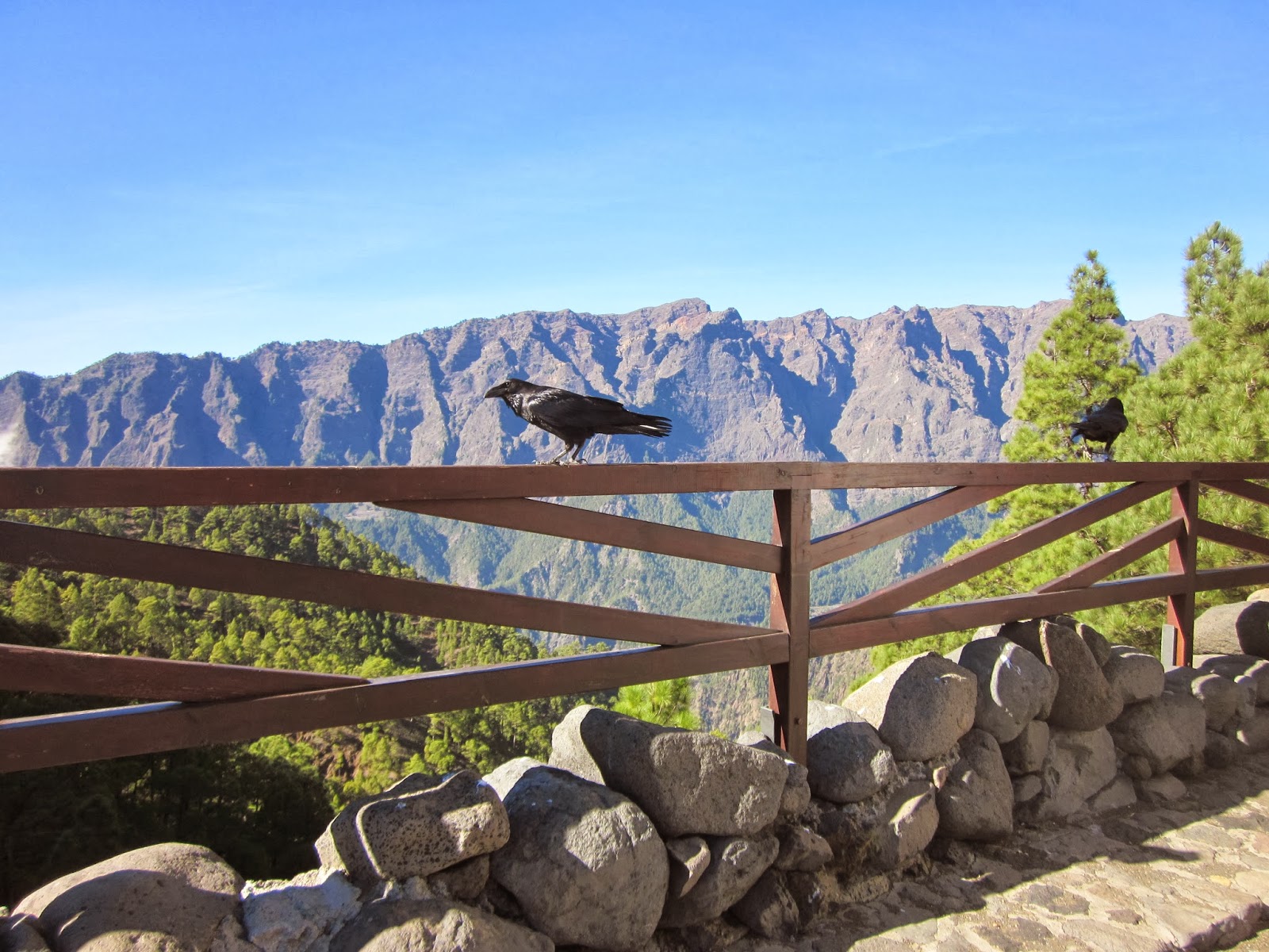
(photo taken a previous time)
It was after this that we immediately went wrong by crossing the bridge too early! However, it transpired that by walking it in this direction, not only was this the longer and more scenic route to Las Nieves covered in the first half leaving the shorter and less glamorous return route for later, but this is the way the signs indicate.
So ... having crossed the bridge 50m uphill from the Naval Museum to the other side of the barranco (river bed/ravine), we continued up the road with the barranco now on our left. In just two minutes, the first sign appeared which was by the corner of a house and which indicated Santuario de Las Nievas. This is where 'helpful man' keeps watch from his flat roof indicating where walkers should go. I can't of course completely guarantee he will be there when you walk the route but I feel there is a good chance.
The route from there wends uphill along stone steps and behind a staggered row of houses until five minutes later it arrives at the lovely Plaza de la Encarnacion with its benches and sturdy laurel trees all presided over by the parish church of Nuestra Señora de la Encarnación. This place of worship apparently was the first to be built in Santa Cruz de La Palma after the Spanish Conquest and the second on the entire island. If nothing else, it's probably worth a quick nip up to see it for its historical importance.
Leaving the plaza and church behind, we now set off directly from the plaza up a straight road lined with houses of every different type. Straight uphill roads are not my absolute favourite I have to admit but the houses proved interesting enough and after all, our goal of Las Nieves was only at 250m above sea level so this was just a gentle exercise rather than some madcap near vertical ascent such as on other walks.
Fifteen minutes later, we were treated to another church, or hermitage, the Ermito del Santo Cristo del Planto, founded in 1611.This was starting to turn into a 'route of the churches' which can often be the case on La Palma.
Two minutes after this church, the route takes a 90 degree right turn and onto a very pleasant wide and flat cobbled path. Time to look around - there's usually a goat down in the valley somewhere. Oh yes, we weren't disappointed.
Four minutes later, the route had done with the flat bit and we swung a 90 degree left as indicated by the sign and were heading directly uphill again. Ten minutes of walking uphill on a fairly gentle gradient, we were then thrown into a bit of a quandary when we came to a junction which offered the Santuario de las Nieves por carretera (by road) or the Camino del Dorador. Well, we didn't want to go by the road and so pondered on that idea that the Camino (path) del Dorador was probably some form of code word for Las Nieves. And in fairness, it seemed that Las Nieves hadn't been mentioned recently, only the Camino del Dorador.
But it wasn't the right way and after ten minutes we were back at the sign for Santuario de las Nieves (por carretera) and resigned to a potentially longish stretch by road. But in fact, it was only a few minutes until we came to a fairly major T-junction where we took a left and then as we rounded a bend, we could see the Santuario ahead of us.
I did wonder if this was going to be a long stretch of road where you walk and walk, never getting any nearer and Las Nieves would forever be an illusion on the hillside. This is after all the pilgrim's route and I've got a good imagination. But no, there were to be no heroics and in seven minutes we had closed right in on our goal. Interestingly (slightly), we were now at a junction where a new bypass was built about six or seven years ago because up to that point, the narrow road went right through the gap between Las Nieves church and the 'House of Pilgrims' which is opposite. An absolutely picturesque route but in reality completely impractical in terms of traffic.
However, for walkers heading up to Las Nieves, it is slightly unclear as there isn't a signpost, although there is a white over yellow blaze on the high stone wall which might suggest, and correctly so, that you turn left and walk uphill. Just two minutes later and a short cobbled path takes up to the Santuario de Las Nieves.
 Now that you have arrived, you can spend a very pleasant time looking around the church, the Casa de Romeros (House of Pilgrims), the gift shop and there is also a restaurant.
The outside of the church is not particularly awe-inspiring, apart perhaps from its large size, but it's the interior which is what most people come to see. And this is after all where the statue of Nuestra Señora de las Nieves, the patron Saint of the La Palma, resides apart from once every five years when in a great procession she is brought down to Santa Cruz (The Bajada).
When it comes to the 'other' things to see and do at Las Nieves, I must admit we were slightly out of luck. The restaurant La Parilla Las Nieves was closed, it being a Thursday, but normally it is open 12.30 to 17.00hrs and then 19.00 to 23.30hrs. A return trip by car to test it out is called for!
The House of the Pilgrims was also undergoing restoration works which look as if they will continue for a month or two yet. But I'm sure that will be worth a visit when it is open again.
The souvenir shop is however open every day but you won't find anything such as traditional embroidery, cigars or even key rings with a plastic bunch of bananas. It's strictly all things religious and to do with Las Nieves. If that's what you are looking for, then you are in a very great deal of luck.
The return route along the PR-LP 2.2 begins just outside of the souvenir shop where a signpost indicates Barco de La Virgin 2.8 km away. The route at first is a slightly awkward downhill path over loose stones but after just a few minutes levels out and is a gentle amble back down to the capital. In fact, just after two minutes and you are on the flat passing an old building where goat's cheese is smoked. It's a smell that to me is quite iconic of La Palma!
After this, the route criss-crosses the stony barranco, all signed perfectly well and with little chance of going wrong or mis-interpreting the signs. Along the way, you can have fun spotting caves and a few old stone dwellings.
Thirty minutes after leaving Las Nieves, we arrived at a goat farm where the route goes right past the goat shed. We very much had the feeling that we had reached civilization - not that I have begun to mistake goats for people but more the fact that we were on a concrete road with a few houses about.
However, five minutes later we had reached the city bypass but still with 1.3km to go before reaching our start point. Wondering how we should best tackle crossing this major road, in fact it was very easy as the route takes you to the left and a slip road with zebra crossing and then a second slip road, again with zebra crossing. The traffic was so light that we didn't need cars to stop for us but at peak traffic times, I can imagine that more care is needed.
The route brought us down through the housing area of Benahoare and, on our right, the barranco with a few chickens and cockerels scratching a living. At the first bridge which crosses the barranco, there didn't seem to be any indication of where the route went, but we crossed it anyway and it turned out to correct. We also realised at this point that this was where Mr. Rother had intended us to walk. From here on in, it was downhill all the way until we reached the Naval Museum a few minutes later.
All in all, a lovely walk which is not too taxing and a good idea to combine it with lunch at the Restaurant Las Nieves. Just not on a Thursday.