Showing posts with label Reventon Pass. Show all posts

05/04/2015

Treking on the GR131 El Baston - final section!

Who would have thought it - we finally finished walking the GR131 La Palma El Baston route in its entirety!  Or trekking the GR131 should I say? It's certainly not your average walk at over 70km along mountainous terrain all the way from sea level in the south up to 2426m in the mid-north of the island and back down to sea level in the west.
Roque de Muchachos at 2426m asl on a non-walking day!
 Yes, it's been a pretty elusive goal and if it wasn't already, we've certainly made it so. But with the tiny bit between Pico de La Cruz and Mirador Los Andenes completed, we can finally tick the GR131 off our list.
The GR131 is the red line going up the middle and hooks round to the mid-west. 
So here's a summary of the long distance trekking route, GR131 El Baston.
The route can be walked in either direction by starting at the extreme south below Los Canarios or at the Puerto de Tazacorte in the west. But whichever way you look at it, the sections tend to be divided:
1. El Faro (lighthouse) of Los Canarios/Fuencaliente to the Zona Recreativa de El Pilar
2. El Pilar to Roque de Muchachos
3. Roque de Muchachos to Puerto de Tazacorte
The Volcano Route
The middle section is 28km (see more on distances below) so it's a bit long for a day's hike and a bit short for two.
The logistics are not completely easy as along the whole route, there is nowhere to buy food or drink and no accommodation apart from the un-manned Refugio de Los Roques (which is between El Pilar and Roque de Muchachos). However, there is drinking water at El Pilar campsite along with toilets and showers, plus BBQ facilities. There is rain water at Refugio de los Roques (but you must use sterilizing tables). Normally there is water at the Roque de Muchachos but the tap can be frozen in winter.
El Pilar - ready for any weather and an overnight stop at the Refugio Los Roques
For those who like the facts and figures, here they are:
23.63km  - Los Canarios to Refugio El Pilar (the Volcano Route)
28.1km  - Refugio El Pilar to Roque de Muchachos
17.9km  - Roque de Muchachos to Puerto de Tazacorte
Reventon Pass - this is your get-out clause down to either el Paso or Santa Cruz
And some sub-distances within the above:
7.2km    - Faro de Fuencaliente to Los Canarios
18.4km  - Refugio El Pilar to Pico de la Nieve
7 km      - Refugio El Pilar to Reventon Pass
9.7km     - Pico de la Nieve to Roque de Muchachos
4.9km     - Pico de la Cruz to Roque de Muchachos
10.7km   - Roque de Muchachos to Torre del Time
3.5 km    - Mirador el Time to Puerto de Tazacorte
(I can't claim that the distances are 100% accurate as the data is taken from the walking signs)
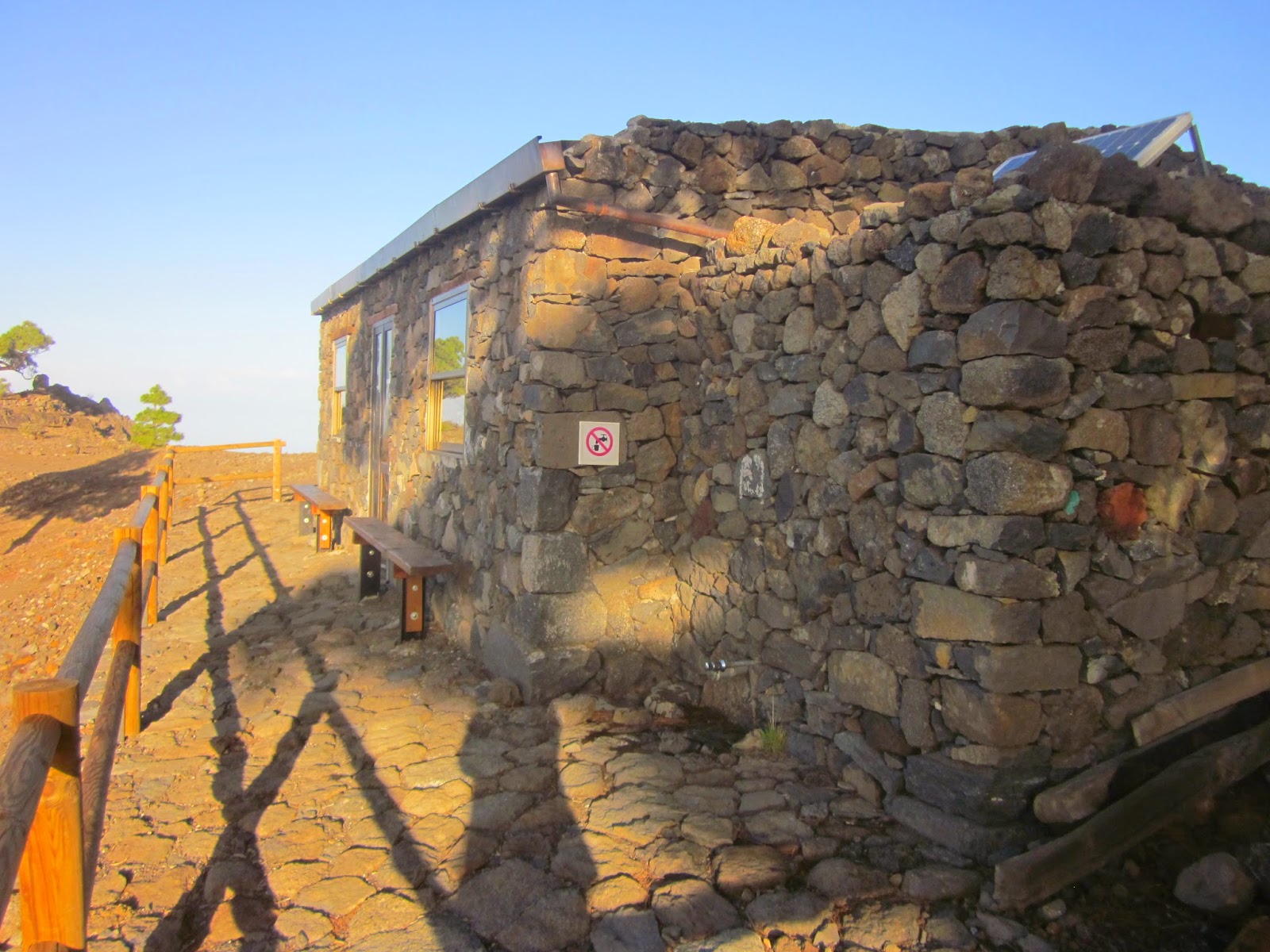
Dawn at Refugio Punta de los Roques
(I've just got to go back there!)
On accommodation, El Pilar campsite is manned by wardens during the day. Theoretically you need a permit to stay there and this is where you apply.  If you don't have a permit the wardens certainly need your details.
You don't need a permit for the Refugio de los Roques and it is never locked. It has a great system  of entry with an inner and outer heavy metal door. This means that the wind can't blow the door open so it is not full of leaves and dust and forest animals can't enter either. But you will need a sleeping bag and preferably a ground pad/yoga mat. See our previous post
January 2015 near Pico de la Cruz - it can be cold even when sunny!
Pico de la Cruz (not the most beautiful landmark ...)
Don't be fooled into thinking there are many 'flat' sections - there aren't! But of course the views are spectacular. You can find more information on distances and ascents/descents at the La Palma walking website: 
 http://www.senderosdelapalma.com/es/senderos/senderos_por_isla.php
Information board at Mirador Los Andenes
Which section has been my favourite I hear you ask. Without having to think about that hardly at all, I would say from the Reventon Pass to Pico de la Cruz, the reason being is that it is the most inaccessible and least walked. It gives the sensation that you are walking in some place far, far away from civilization, somewhere really special. Well, you are.
The highlight, or one of them at least, is reaching the Refugio de los Roques. I might be over-exaggerating but it's the Trip Advisor camping equivalent  of a Parador (elite Spanish accommodation) in that you can only get there if you've walked the walk. And we did.
Sleeping platforms at Refugio de los Roques
It's been a hard day's night
For accommodation at the Puerto de Tazacorte where the GR131 begins/ends, take a look at our main website, Holiday La Palma

30/10/2014

Walking the GR131 El Baston from El Pilar to Pico de la Nieve (and beyond)

It seems ridiculous to say that I've wanted to do a particular walk on La Palma for years, yes literally years, and still not done it. I mean, why wouldn't you just go and do a walk if you want to do it, especially when we live just a 50 minute drive away from one end of it. But the fact is that this isn't an ordinary walk - no, we're talking logistics here. And an overnight stay in a refuge hut.
GR131 walk 1 So finally having given up on waiting for the 'right time' to walk it, when it's not too hot, not too cold and we're not too busy or too unfit, it was a case of just doing it. I have to say that it was probably not the most perfect time, especially as we couldn't start the walk until late-afternoon but sometimes walkers can't be choosers. And so off we set with the small matter of 28km of fairly continuous ascents and descents most of which is at altitude, bed rolls and sleeping bags. Glee :) I love an adventure...
GR131 signs
The start of the walk was crazy-easy with the walking path crisscrossing over a forestry track. But nice to be able to walk over the pine needles on the ground with the tree heather lining the path. And within an hour, we are starting to get some tantalizing views. I don't know if it's what I had expected, we're used to outstanding views, but I hadn't seen this one.

GR131 walk 3

GR131 walk 5

And not too much further along the route, we came to the aerials we had seen not so long ago in the distance. This was something of a way-point and we were making pleasing headway. Plus some even better views over to the east as picked we out Los Cancajos and the airport in the distance. 
GR131 walk 4

GR131 Reventon Pass

GR131 walk 6
Perhaps a more significant waypoint was reaching the Reventon Pass, the intersection of the GR131 and LP1 walking route which crosses the centre of the island from Santa Cruz in the east, up and over to the Virgen del Pino at El Paso and eventually to Tazacorte in the west. It's 7km from El Pilar and another 7km to the Refuge hut - it's a good place to pause a while, top up with drinking water from the fountain and enjoy the view of both the east and the west.
GR131 walk 7
By the way, the red line on the map above shows the whole route of the GR131 - this is the one that the Transvulcania athletes run in day. I kid you not.
I think it was after this point that the route started to get a bit more serious with an amazing number of ascents and descents kicking in, especially considering that overall we were not gaining a huge amount of altitude. Oh well, así es la vida, full of ups and downs.
GR131 walk 8
With fabulous views continuing we didn't hang around long to take photos but it was more a case of taking in the view while still walking. After all, darkness falls quickly and we still had a long way to go. So speeding up as much as possible, we walked the last part in increasing gloom and when we finally reached the refugio, it was all but dark. Happily (if that's the word) we had armed ourselves with torches.
 GR131 walk 8Now, I've never been to the Refugio before although I've seen photos and heard reports about it, but I must say I was very pleasantly surprised. I had somehow imagined bare bunk beds with broken lats, a creaky door hanging off its hinges and a dusty soil floor. But in fact it's an absolutely brilliant little building with quite two quite big rooms, one with good, strong, clean sleeping platforms and the other with two large tables and benches. Oh and a heavy, self-closing front door immediately followed by a heavy self-closing interior door with zero change of blowing open in the night. There are a few basics to help walkers too - an excellent first aid kit and some sweeping brushes to keep the place clean and free of tasty morsels dropped on the floor. Outside there is a water tap, although water purifiers are recommended. The Refugio is completely free of charge, does not need a permit and is never locked. 
GR131 walk 16


GR131 walk 15I can't say that I've slept on a hard surface recently - not that I remember anyway (!) And at many points in the night, there didn't seem to be much sleeping happening but come 9 o'clock in the morning, I had to be cajoled out of my little nest. I'd already missed the sunrise I had so wanted to see but luckily David had taken plenty of photos. Early morning is such a beautiful time, bathed in the stillness of a day waiting to begin. And to know that we were right there on the trail in the wilderness was something that did not pass us by.

GR131 walk 9
GR131 walk 18

GR131 Refugio Punta de la roques

GR131 refugio punta de los roques

GR131 refugio punta de los roques la palma


The walking trail led us behind the Refugio and almost straight away, we were descending on a path slippery with pine needles. And there's one thing we were sure of - that going down was not the overall plan. But after I had a quick and unplanned meeting with the ground, we were on our way back up again. With breathtaking scenery virtually every step of the way and just 2.5 hours later, we reached Pico de la Nieve. 
GR131 walk 22

GR131 walk Pico de la Cruz
GR131 walk 20GR131 walk 21
 GR131 walk b GR131 walk c
 For those of you who might be interested in the logistics, we chose to walk in a northerly direction starting at El Pilar (1455m) with an overnight stop at the Refugio Punta Los Roques (2075m) and ending at Pico de la Cruz (2351m). To get to the start, we took a taxi from the capital of Santa Cruz up to El Pilar which is where the Volcano Route ends and the next section of the GR131 begins.
The Refugio is a fabulous resource which sleeps up to 20 people - more information on the official La Palma walking site here: Senderos de La Palma. You can also see the profile and distances on that site too.